Largely, yes. An insurance company's main assets are not the buildings it occupies but the financial reocrds which, believe me, are double triple backed up at offsite recovery centers, etc. In relative comparison, the working buildings are not that significant a piece of the operation.
As for buildings owned as investments, you bet they are insured by others. Typically, however, with large retentions (deductibles) as the point would be to
insure only against catastrophic degrees of loss.
Important MessageYou are browsing the archived Lancers Reactor forums. You cannot register or login. |
Pray for us here
This is where you can discuss your homework, family, just about anything, make strange sounds and otherwise discuss things which are really not related to the Lancer-series. Yes that means you can discuss other games.
71 posts
• Page 3 of 5 • 1, 2, 3, 4, 5
![]() Thu Sep 02, 2004 10:00 am
Thu Sep 02, 2004 10:00 am
Phew fianlly got the yard cleaned up and the windows covered with the metal..all we can do now is wait and sit on edge.....here is the latest i got from the national weather service. (i live in orange county):0 the new here has the storm's eye tracked 5 miles south of my house!! The entire metro orlando area here is readying for the estimate 20+ inches of rain that is "assumed" ( i hate that word) to be dropped on our heads from Fri night till Mon early morning...(yes friday till monday...what a bummer )
)
i swear, i ave livved in florida my whole life and we never gt hit in orlando by "hurricanes"...minor tropical storms yes, Hurricanes NO! what the hell makes this year any different!... Sorry didn't mean to B****, just a little frustrated cause we have yet to full recover from charley...hell there are STILL big ass oak trees laying in peoples yards throughout the Winter Park, Casselberry, Kissimee, Orange Park, and other areas around here.( i'm in Winter Park like 5 minutes from Downtown Orlando).
The streets area mess, over 1 million have been issued a mandatory evac notice from somwhere in the keys to all the way to Flagler Beach...(North Daytona Area for those not from around here).
by the way...the wife and i would like to take a second to say thanks for your concerns and thoughts...shows a lot of compassion form you all makes TLR a great little community...errr.. FAMILY!
i'll update ya later see ya! (unless i blow away )
)
Severe Weather Alert from the National Weather Service
...HURRICANE LOCAL STATEMENT NATIONAL WEATHER SERVICE MELBOURNE FL 11 AM EDT THU SEP 2 2004
... DANGEROUS HURRICANE FRANCES HEADING FOR FLORIDA EAST COAST... ... ALL PREPAREDNESS ACTIONS MUST BE RUSHED TO COMPLETION TODAY... ... HURRICANE WARNINGS ISSUED FROM FLORIDA CITY TO FLAGLER BEACH INCLUDING ALL OF EAST CENTRAL FLORIDA COAST... ... INLAND HURRICANE WIND WARNING ISSUED FOR INTERIOR COUNTIES OF EAST CENTRAL FLORIDA...
... AREAS AFFECTED... THIS HURRICANE LOCAL STATEMENT RECOMMENDS ACTIONS TO BE TAKEN BY RESIDENTS OF THE FOLLOWING COUNTIES... VOLUSIA... LAKE... SEMINOLE... ORANGE... BREVARD... OSCEOLA... INDIAN RIVER... SAINT LUCIE... MARTIN AND OKEECHOBEE.
... WATCHES AND WARNINGS... A HURRICANE WARNING IS IN EFFECT FROM FLAGLER BEACH SOUTH TO FLORIDA CITY... WHICH INCLUDES ALL OF THE EAST CENTRAL FLORIDA COASTAL COUNTIES... AND ALSO LAKE OKEECHOBEE. AN INLAND HURRICANE WIND WARNING IS IN EFFECT FOR OKEECHOBEE... OSCEOLA... ORANGE... LAKE ... INLAND VOLUSIA AND SEMINOLE COUNTIES. A FLOOD WATCH HAS BEEN ISSUED FOR FRIDAY THROUGH SUNDAY MORNING FOR ALL OF EAST CENTRAL FLORIDA.
"To live is to die....but living is to die slowly..why waste time on trivial things just play as hard as you can"
i swear, i ave livved in florida my whole life and we never gt hit in orlando by "hurricanes"...minor tropical storms yes, Hurricanes NO! what the hell makes this year any different!... Sorry didn't mean to B****, just a little frustrated cause we have yet to full recover from charley...hell there are STILL big ass oak trees laying in peoples yards throughout the Winter Park, Casselberry, Kissimee, Orange Park, and other areas around here.( i'm in Winter Park like 5 minutes from Downtown Orlando).
The streets area mess, over 1 million have been issued a mandatory evac notice from somwhere in the keys to all the way to Flagler Beach...(North Daytona Area for those not from around here).
by the way...the wife and i would like to take a second to say thanks for your concerns and thoughts...shows a lot of compassion form you all makes TLR a great little community...errr.. FAMILY!
i'll update ya later see ya! (unless i blow away
Severe Weather Alert from the National Weather Service
...HURRICANE LOCAL STATEMENT NATIONAL WEATHER SERVICE MELBOURNE FL 11 AM EDT THU SEP 2 2004
... DANGEROUS HURRICANE FRANCES HEADING FOR FLORIDA EAST COAST... ... ALL PREPAREDNESS ACTIONS MUST BE RUSHED TO COMPLETION TODAY... ... HURRICANE WARNINGS ISSUED FROM FLORIDA CITY TO FLAGLER BEACH INCLUDING ALL OF EAST CENTRAL FLORIDA COAST... ... INLAND HURRICANE WIND WARNING ISSUED FOR INTERIOR COUNTIES OF EAST CENTRAL FLORIDA...
... AREAS AFFECTED... THIS HURRICANE LOCAL STATEMENT RECOMMENDS ACTIONS TO BE TAKEN BY RESIDENTS OF THE FOLLOWING COUNTIES... VOLUSIA... LAKE... SEMINOLE... ORANGE... BREVARD... OSCEOLA... INDIAN RIVER... SAINT LUCIE... MARTIN AND OKEECHOBEE.
... WATCHES AND WARNINGS... A HURRICANE WARNING IS IN EFFECT FROM FLAGLER BEACH SOUTH TO FLORIDA CITY... WHICH INCLUDES ALL OF THE EAST CENTRAL FLORIDA COASTAL COUNTIES... AND ALSO LAKE OKEECHOBEE. AN INLAND HURRICANE WIND WARNING IS IN EFFECT FOR OKEECHOBEE... OSCEOLA... ORANGE... LAKE ... INLAND VOLUSIA AND SEMINOLE COUNTIES. A FLOOD WATCH HAS BEEN ISSUED FOR FRIDAY THROUGH SUNDAY MORNING FOR ALL OF EAST CENTRAL FLORIDA.
"To live is to die....but living is to die slowly..why waste time on trivial things just play as hard as you can"
![]() Thu Sep 02, 2004 10:16 am
Thu Sep 02, 2004 10:16 am
Good luck DS.
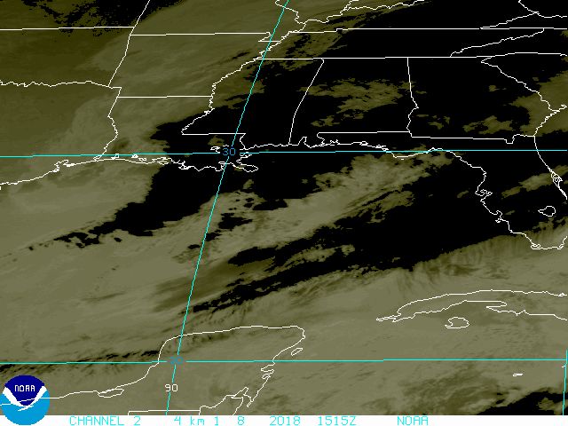
Current storm path projection Yikes!
<Edit>
Made landfall with 105 mph winds.
@Warrior..... past ten years? Has it been that long already? Let's see.... 1994.
Hmmm. You're right. The change in direction started back then. I don't know why but I thought it's only been 5 years.
The "northerly" trend was supposed to indicate that more of the storms would be making close to first real landfall on the US coastline than before and usually on the Atlantic side.
Thank you.
Edited by - Indy11 on 9/2/2004 1:23:37 PM
<Edit>
It was weather trend article that was published quite a while ago. I have to go find it now.
Anyway, I don't mean 1994 exactly to the day. I mean that it seemed only about 5 years ago that I read it but now I realize it was longer than that.
*forgot where he put his gingko biloba pills*
Edited by - Indy11 on 9/2/2004 2:19:14 PM
Edited by - Indy11 on 9/4/2004 10:36:37 AM
![]() Sat Sep 04, 2004 7:32 pm
Sat Sep 04, 2004 7:32 pm
Hi everyone figured i would post a quick message before the power goes bye-bye,
The winds have picked up a bunch and a few trees are layin in the road, but thats just the start, aroun 2am the real Sh** will start. My area is slated to have 85-110mph sustained winds for about 10 hours straight and dumping around 17-19 inches of rain..(anyone have a canoe? ).
Well have a good night TLR time to light the candles, and watch the town get layed to waste.
Later all
"To live is to die....but living is to die slowly..why waste time on trivial things just play as hard as you can"
The winds have picked up a bunch and a few trees are layin in the road, but thats just the start, aroun 2am the real Sh** will start. My area is slated to have 85-110mph sustained winds for about 10 hours straight and dumping around 17-19 inches of rain..(anyone have a canoe?
Well have a good night TLR
Later all
"To live is to die....but living is to die slowly..why waste time on trivial things just play as hard as you can"
![]() Sun Sep 05, 2004 3:28 am
Sun Sep 05, 2004 3:28 am
apparently there's 13'000 electric personell waiting for it to pass to go in and re-establish power along with alot of other rescue personell. so i think it wont be long. but since the eye is passing so damm close to his house, there might be more debri for the workers to get through, or wade through.
![]() Tue Sep 07, 2004 4:56 am
Tue Sep 07, 2004 4:56 am
57 out of 67 counties in Florida have some degree of significant power loss. Orlando area was fairly badly hit.
More concern now is the amount of water that's been dumped on the ground.
There's a little town just south of Orlando that is the direct nexus of both Charley's path and Frances'.
Hope all is OK. Death toll was not as great as it could have been. Still a few souls were lost.
More concern now is the amount of water that's been dumped on the ground.
There's a little town just south of Orlando that is the direct nexus of both Charley's path and Frances'.
Hope all is OK. Death toll was not as great as it could have been. Still a few souls were lost.
71 posts
• Page 3 of 5 • 1, 2, 3, 4, 5